Cartography Design
Here are some maps that I made using ArcMap and Adobe Illustrator.
Skill and Tools: GIS, SQL analysis, Batch Script, RStudio, QGIS
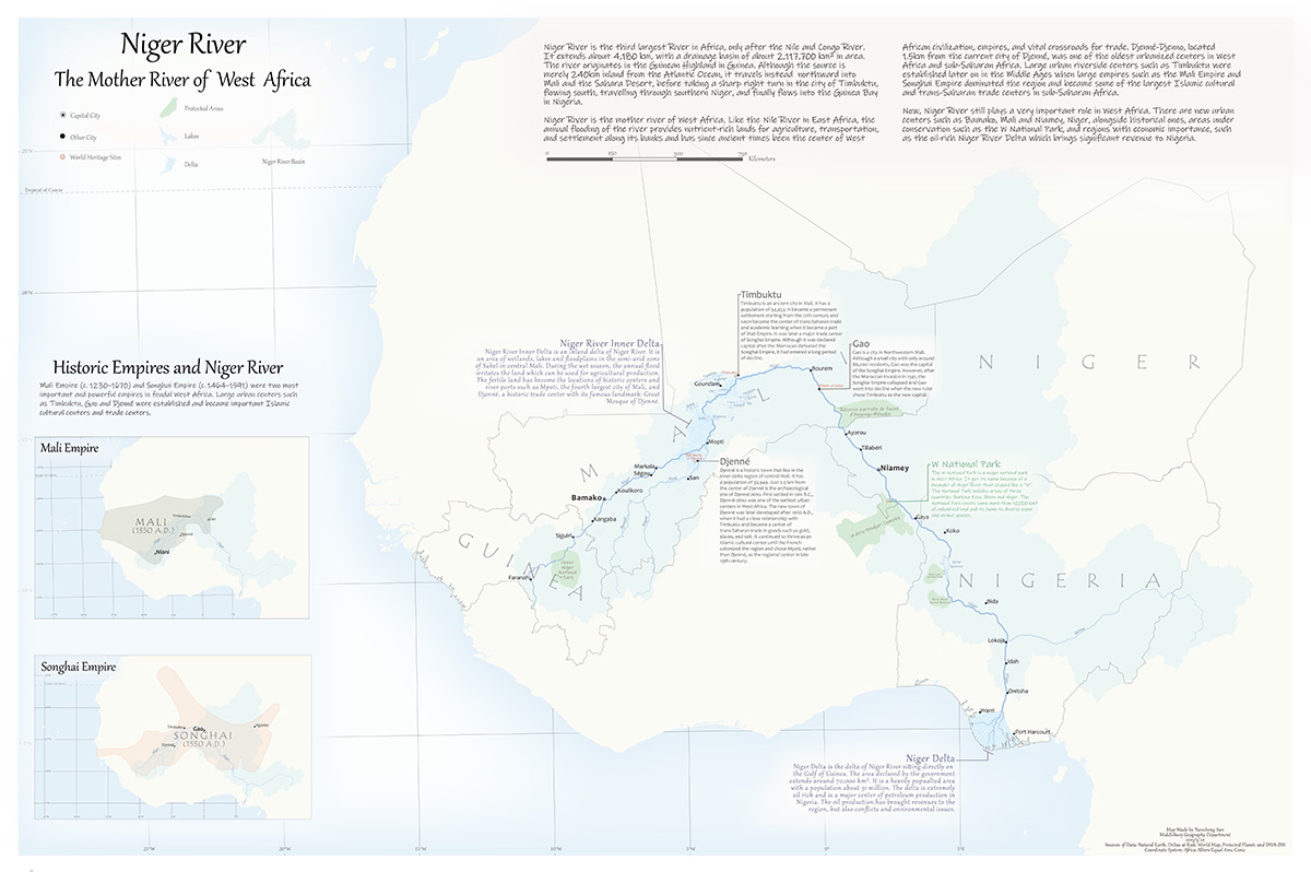
Niger River, the mother river of West Africa
This is a map showing Niger River and the cultural and physical geographic locations related to it.
• Designed a thematic map of the geographic and cultural importance of Niger River in both modern and historical times using Adobe Illustrator.
• Collected shapefile geographic data from Natural Earth, Deltas at Risk, Protected Planet and DIVA-DIS and compiled in ArcMap.
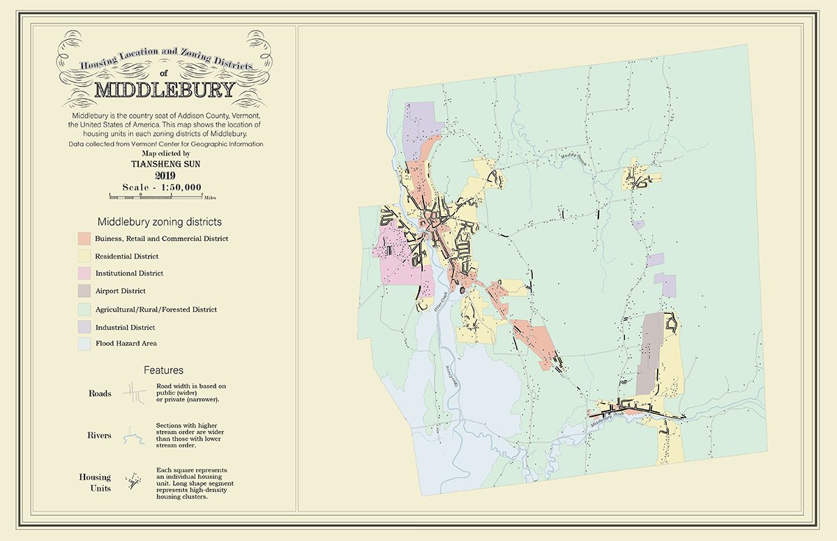
Housing Location and Zoning Districts of Middlebury
This map shows the location of housing units in each zoning districts of the town of Middlebury, the country seat of Addison County, Vermont, USA.
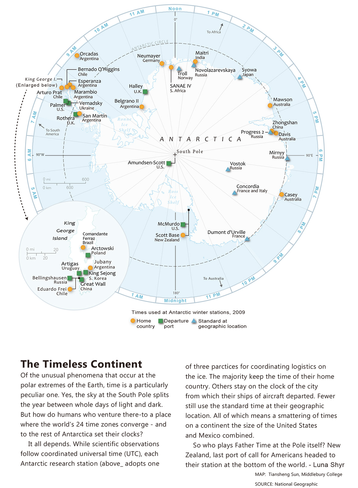
This article is a reproduction of a National Geographic map: the Timeless Continent. This maps show how time is used at Antarctic winter stations in 2009.
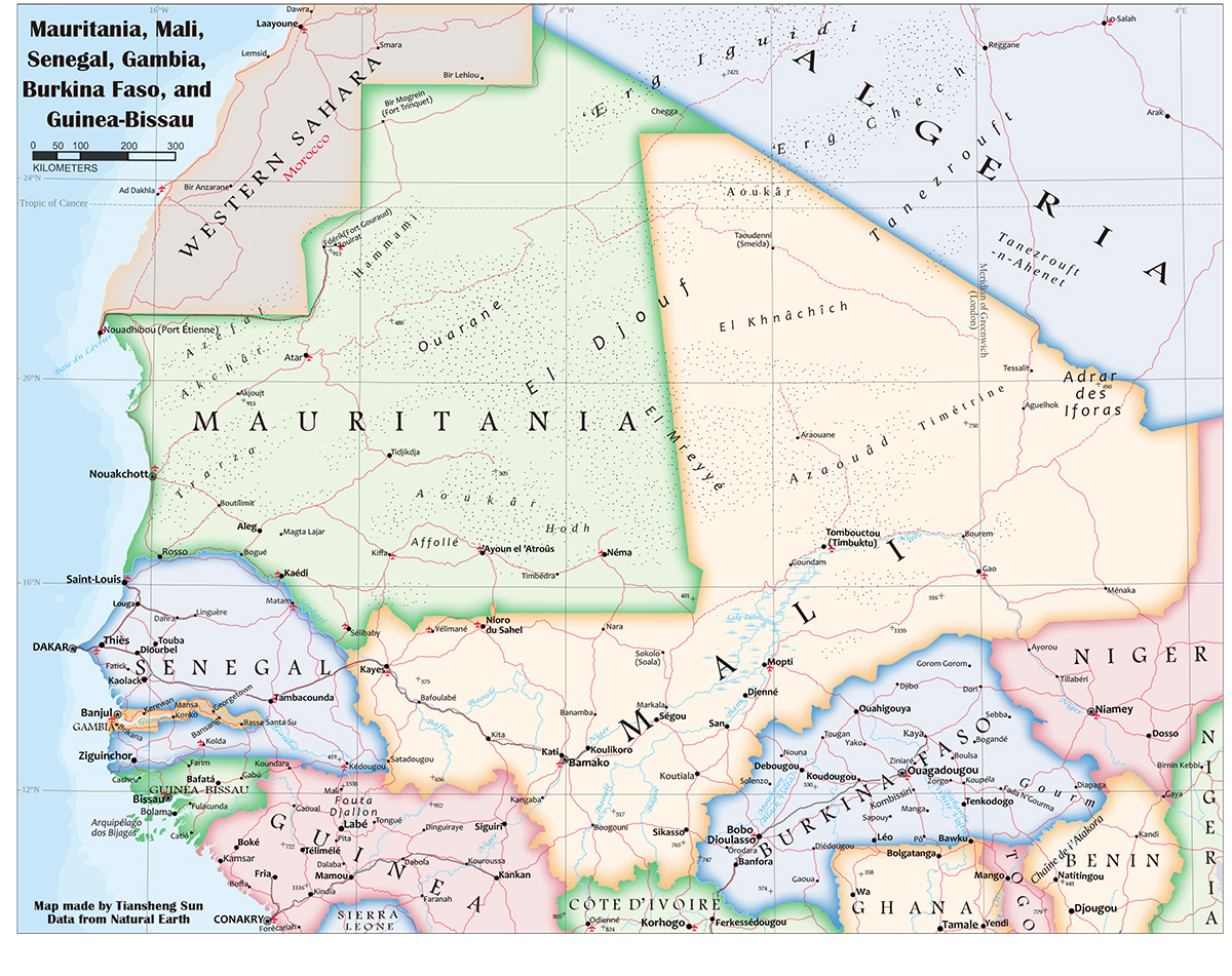
Map of Mauritania, Mali, Senegal, Gambia, Burkina Faso, and Guinea-Bissau
This is a reference map of the Sahel and Saharan region of West Africa, showing each countries' major cities, roads, airports, rivers and so on.

Niger River, the mother river of West Africa

Housing Location and Zoning Districts of Middlebury

The timeless Continent

Map of Mauritania, Mali, Senegal, Gambia, Burkina Faso, and Guinea-Bissau